An in-flight, air-to-air photo of a Pilatus PC-12 as it flies straight and level over a small lake and river situated on a scrubby plain. The camera plane is positioned slightly above the PC-12 so that the camera is looking down at the aircraft, which highlights the landscape. The aircraft flies from left to right in the frame, and slightly toward the camera. Flamingoes are visible on the sandy plain just below the river in the image. Mount Ol’Doinyo, with only a dusting of snow on its peak, is visible in the distance. The aircraft is mostly white, with a curvaceous, graphic pattern consisting of various shades of gold on the lower part of the fuselage and the tip of the vertical stabiliser. The registration « 5H-MAG » is painted on in the vertical stabiliser in black, bold letters. Original caption from source: « The PC-12 over Lake Natron and its flamingoes,with Mount Ol’Doinyo volcano in the background. » (📸 ©2017 Jon Davison | Eye in the Sky Productions) (📸 ©2017 Jon Davison | Eye in the Sky Productions)
The PC-12 over Lake Natron and just some of its 2.5 million lesser flamingoes, with Mount Ol’Doinyo volcano in the background. (📸 ©2017 Jon Davison | Eye in the Sky Productions)
Under African Skies
In Part IV, the final part of this series, author and photographer Jon Davison wraps up with a final day's shoot with Maasai tribesmen near the active volcano Mount Ol’Doinyo.
By Jon Davison

After we landed, I was constantly shivering for hours, as I had lost my core heat. I had never experienced this before, and I could not control it. I felt a real idiot for not anticipating this. But to be fair, I did some research prior to going, and was also informed by a few ex-pats at home summer in Tanzania, it will be warm Jon, no problem. Maybe, but I bet they had never flown in an environment like this before!

Back to the hotel in Arusha for an early start tomorrow to Manyara and the Serengeti. I edited and uploaded low-res files via Dropbox to Pilatus, who wanted to see the progress. Gilles had suggested we all meet up for a pizza at a local restaurant, which was great. The local Serengeti beer went down a treat, but I was still shaking inside even after five hours.

Early next morning I woke up shaking? It can’t still be the cold, I thought? But the shaking got stronger, then the bed and the room started moving! Shit! It was an earthquake. I jumped out of bed; telegraph poles were swaying outside, with dust and smoke everywhere. Then the sirens went off, but not much damage. Suddenly it was all over.

In the silence afterwards, anticipating the typical second shake, I remember thinking how loud it all was. An interesting start to the day, I thought. Later I found out that there had only been three quakes in the last thirty years or so, and all had been prior to an eruption by the nearby 10,459-foot Mount Ol’Doinyo volcano, which we would be flying around today. Mmmm! Well, let’s see.

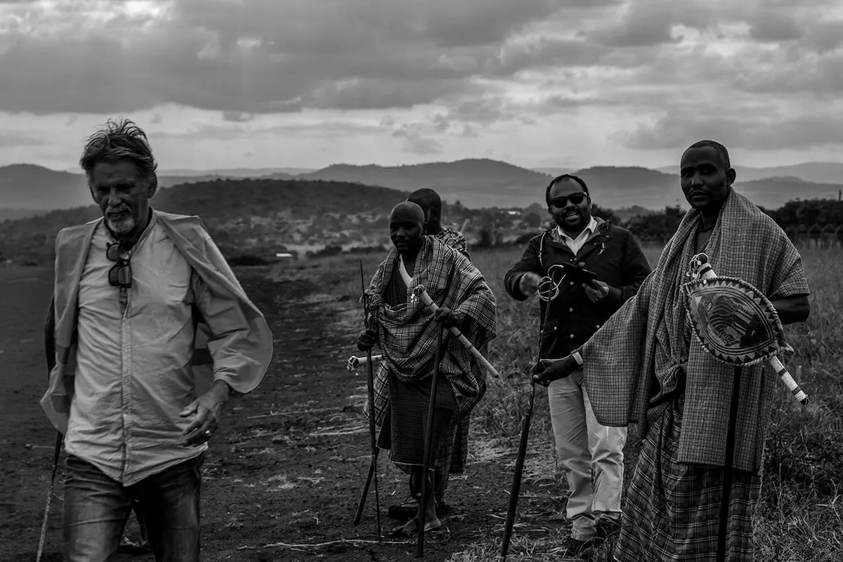
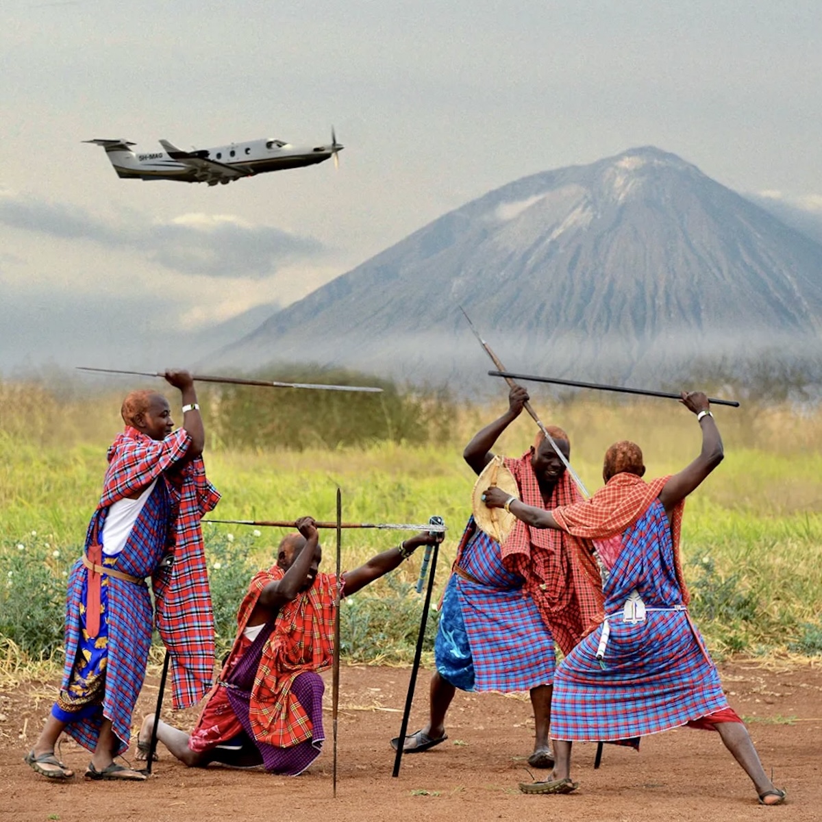
We left Arusha and headed north to Manyara, by way of Ol’Doinyo and Lake Natron for some low-level shots. For most of the journey, I was transfixed by the Maasai bomas that dotted the dusty brown landscape with their distinct circular corrals. For miles beforehand, the horizon was dominated by the picture-perfect outline of Ol’Doinyo; there was just something about this volcano; it was a very clean cone rising out of a pitted, yellow and brown volcanic landscape. But thankfully, there was no smoke! Maybe the quake was just a teaser, although there was a hint of sulphur in the air! Maybe it won’t blow today, I hope!

We spent quite a bit of time circling the cone and the areas around it, getting the right angles for the shots. The PC-12 looked great at any angle with Ol’Doinyo just behind it, silhouetted, head on, side on, it didn’t matter. I shot some nice frames here. Mark was firing away as well, and even though it was still bloody cold, we barely noticed it. It’s only when the buzz is over, then you start to feel your environment.

A black-and-white photo of a group of people walking on a scrubby plain. On the left is Jon Davison, who is walking toward and from the right to left in the frame. Slightly behind him, on the right side of his frame and to Jon's left, a group of four people walks in the same direction. Three of the four are Maasai tribesmen wearing their traditional shúkà, whereas the fourth is Mark Mutiso, one of the photo shoot crew members, with a camera and other equipment around his neck.  In the middle distance, a series of rolling hills is visible. Above, the sky seems to be gathering storm, although it's difficult to discern given the lack of colour in the photo. (📸 ©2017 Jon Davison | Eye in the Sky Productions) (📸 ©2017 Jon Davison | Eye in the Sky Productions) A group of four Maasai tribemen wearing their traditional shúkà are carrying their distinctive spears and are pictured engaged in mock combat. In the background, the Pilatus PC-12 rises from the landscape and climbs out. The aircraft is flight from left to right in the frame. In the far distance, Mount Ol’Doinyo rises above the grassy plain. (📸 ©2017 Jon Davison | Eye in the Sky Productions) (📸 ©2017 Jon Davison | Eye in the Sky Productions) A group of four Maasai tribemen wearing their traditional shúkà are carrying their distinctive spears and looking at the camera over on the right side of the frame. On the left, a Pilatus PC-12 is either landing or taking off from a red earthen strip and is kicking up a cloud of red dust. Mount Ol’Doinyo rises in the distance, with its peak just out of frame. A small, stratus cloud obscures some of the volcano. (📸 ©2017 Jon Davison | Eye in the Sky Productions) (📸 ©2017 Jon Davison | Eye in the Sky Productions)

Next, it was on to the fifty-seven-kilometre-long, multi-coloured-surfaced Lake Natron, with its 2.5 million lesser flamingoes, their only regular breeding ground. It was mesmerising to fly over this salt- and soda-based lake at low level.

The shoot carried on over the next two days in much the same way, with towering volcanoes, pink lakes, and moon-like craters as backgrounds for the ever-nimble and graceful PC-12. I won’t go into further detail, but suffice it to say it was an absolutely stunning and rewarding experience, and of course, working with Pilatus, who need to show that their aircraft are the SUV of the skies, it always is. đź›©ď¸Ź đźŚ˛

***

Have any thoughts or questions on this story? Jon would love to hear from you. You can click or tap any photo in this article for a high resolution version along with a caption, if available. These photos were originally published in 2016 on Jon's personal website, Eye in the Sky Productions. More recently, Under African Skies was first published on Medium. As noted, this article is the fourth and final part of this series. To get back to Part III, click the Previous button down there on the left. Meanwhile, Jon Davison and his wife, Jude Brazendale, have just finished a new book; more details about which you can find by clicking its cover below.

A grey isosceles triangle with the vertex pointing to the left. This icon is used to represent a link to the previous article in the series. A graphic where the primary image is cover of the book entitled « CLIMB HIGHER » by Jon Davison and Jude Brazendale. If features a Robinson R44 helicopter in profile, flying from left to right past a blue/white iceberg. The helicopter is dark in colour and the registration is indistinct. In the distance, other icebergs are visible and then a uniformly grey sky as the background. The book's title appears at the top, with the word « CLIMB » in black and « HIGHER » in white. Immediately below the title are the words « Worldwide adventures with Robinson Helicopters » in black letters. At the bottom of the cover are the words « Jon Davison & Jude Brazendale ». In addition, over on the left, in bold, black letters, are the words « Presented by Jon Davison & Jude Brazendale’s brand new book out on November 17, 2025 at European Rotors. » (📸 Robinson Helicopter Company)